
At work the new year started off with a bang of the wrong kind. It was a short work week that ended up feeling like two. So when PB e-mailed to see if I was interested in paddling today I jumped at the chance. I needed to do something to rebalance the scales and the forecast looked like a winner.
JS had suggested Hull as a possibility and PB and I were keen on taking him up on the idea. Hull is local to Waltham compared to most spots on Narragansett Bay. It is also a spot we don't often paddle. There is too much boat, and beach, traffic during the summer. The Gut also dictates the days it is appropriate to paddle out of Hull.
PB e-mailed JS to see if he was still up for the trip, but JS said he was feeling under the weather. However, he also said he could make himself feel better if we were definitely going. A few e-mails and phone calls later, PB and I decided we were definitely going to go. We hoped that JS, and a few other stalwart RI paddlers, would make the commute to the northern wilderness. There was always the chance that an MA based paddler would see the message board post and show. However, we decided that even if it was only the two of us we'd paddle.
While the standard wisdom is "on the sea always three," we figured that there were conservative routes inside of Hull's protection that would be reasonable. We could circumnavigate Peddocks or explore the Weir River. If other paddlers showed up, we could change routes and explore the outer harbor.
After getting a little lost on the way through Hull (I always get lost getting to the Hull put-in), I found PB and JS getting ready. We had the magic number.
The weather was sunny and calm, but still cold. High tide had just passed so we'd have the current with us. PB wanted to possibly paddle around Lovells, but JS pointed out that it was pretty boring. So, we turned our bows towards Green Island. The rough plan was to lunch on Green. Then we would make our way back to Hull meandering through the Brewsters.
The current pushed us towards Green at a fast clip. JS estimated that we were moving at 5 miles an hour and were not paddling hard. We arrived at Green much earlier and less tired than expected.
Graves Light was looming in the distance and calling in us. Fortunately, JS and PB had their sensible hats firmly attached. We decided not to the extra distance. There is no place to land on Graves and the winter is no time to take silly chances.
Instead, we spent some time wondering if there were any seals in Boston Harbor and then turned towards Outer Brewster to find a lunch spot. Outer Brewster offered plenty of cliffs, frozen rocks, and spots to play. JS and PB found a nice run through some rocks along Outer Brewster and decided to enjoy their new kayaks. PB made the run but scuffed up his bow. JS took a different line through the slot but also managed to scuff his kayak. After watching the other two and the slot, I picked a perfect line and slipped through without a scratch. (It is good being last!!) My scratch free status didn't last long. We found a few other places to play in the rocks and I found a rock that was happy to scuff the Q-boat. I misread how fast the water evacuated an area and rubbed the rocks.
After we played in the rocks and determined that we were not going to lunch on Outer Brewster, we started to move onto Middle Brewster. Before we got very far, we encountered a pod of about six seals. We hadn't seen any seals all morning and thought that Boston Harbor may not have a seal population. These seals seemed curious but kept their distance.
Middle Brewster was also inhospitable for lunch. So, we paddled over to Boston Harbor Light. The landing there is not great, but it is serviceable. I was hoping that their would be a light keeper home so that we could get a tour of the light!! Or just a sheltered spot to eat. Instead, we found a no trespassing sign.
PB found a nice sunny rock ledge, with a back rest, along the beach. We ate a leisurely lunch and had interesting conversation. It was very relaxing, but the sun had slipped behind the hazy clouds and a slight breeze started. We needed to get moving before we got chilled.
The paddle back to Windmill Point was slower than the paddle to the outer islands. The current was against us and the slight breeze chilled us. To pass the time we talked about teaching people how to roll. JS, who is a certified instructor, said to share your own experiences with learning to roll - but not scare the students too much. I was not a roller who picked it up the first, or the 20th, class. We also talked about different ways to approach the technique. JS is a Euro blade paddler and felt that the standard start with hip flicks and move to a C-to-C progression worked best. I had taken a Greenland rolling class where they started with learning how body position effected the balance of the boat and the hip flick was never mentioned. I found the Greenland course to be more helpful than any of the more commonly taught classes. Different strokes for different folks.
Back at the put-in, I felt compelled to do one roll. It is a silly compulsion and today reminded me of just how silly a compulsion it is. I did the roll; it was hardly smooth; I rushed the whole thing. When I popped up my head felt like it was in a vice grip. I wasn't disoriented and could think clearly, but I was in pain. I was very happy to have to excellent paddlers nearby for support and the beach a few feet away.
Once off the water, my headache subsided. We all changed into warm clothes before dealing with the kayaks. The kayaks were quickly car topped. Once our gear was stowed and the kayaks secured, we headed to a nice bakery for coffee and pastry.
With a kickoff like this one, 2008 promises to be a very good year.
Showing posts with label light houses. Show all posts
Showing posts with label light houses. Show all posts
Saturday, January 05, 2008
Starting the Year Off Paddling

Wednesday, October 11, 2006
Isles of Shoals or Isles of Death
H and I decided to skip the camping on Saturday night for a number of reasons. One was the fact that we had to travel to CT for my nephew's third birthday. The other was that H did not want to risk the downsides of sleeping outside on a cool October night before a big adventure.
Like Paul B., H had never done a long open water crossing and was understandably apprehensive. She was concerned about being comfortable in her kayak for two plus hours without a break. She was concerned that the condition might take a turn for the worse while we were on the water. She was concerned for a lot of very sensible reasons. A long crossing in colder water warrants a bit of concern. The trick is to not let the concerns overwhelm your judgement.
The lure of the Isle of Shoals was enough to motivate both of us. H had been out to Star Island with her Mom once and when she lived in Portsmouth she could always see them from the shore. I always dream of kayaking to islands that are at the edge of my vision from shore. To add to the allure there are all sorts of interesting stories about the islands.
We arrived at the put in and were a little put off to find that there was a $10 per car parking fee. It was a little more disconcerting that the coordinators were surprised by the parking fee. I was expecting that they had scoped out the launch site prior to arrival. This was a new area for most of the participants and nobody knew where we could park and launch. The idea of moving the launch site was not something that inspired a lot of confidence.
Since H was familiar with the area we headed out to scout the area for a free parking area that also offered a decent launch site. The two beaches with free parking didn't look like ideal launch sites. They were breaking surf on both beaches. The surf heightened H's concerns because she felt that the surf was a harbinger of rough conditions at sea. This was not far fetched given the rough seas on Saturday.
While we were scouting, the rest of the group decided on a new launch site. It was a small beach/boat ramp just down the road from the original put-in. It was ideal: free parking and a sheltered beach.
Once the put-in was secured, things began running smoothly. There was the discussions about what to wear. It was warm for a fall day, but the water was on the cool side. Would a wetsuit be enough if someone went in the water? Would a drysuit be too warm? Could I get away with shorts and a dry top? H only had a wetsuit, so her decision was easy. I decided to wear my drysuit on the way out. If I was too warm, I could change into shorts and a dry top for the return journey. The rest of the group was pretty evenly split between drysuits and wetsuits. Joe S. was the only daredevil in shorts and a shorty dry top.
The plan: Paddle out to White Island to see the light, make a stop at Star Island, lunch at Smuttynose, and paddle back home. The first and last leg are just over seven miles. At a good pace that meant about two hours each way.
The trip out was pretty mellow. The seas were bumpy enough to keep things lively, but not enough to cause any real concerns. As Carleen warned us, there were occasional rouge waves. The rouges added a trifle more excitement.
From White Island we spotted an obelisk on Star Island. It seemed like an odd thing to put in the middle of an Island that is owned by a church. (Star Island is owned by the Unitarian Universalist Church.) The other obvious structure on Star Island is the huge resort that is used as a retreat and conference center. It started life as a 19th century summer resort for the rich and famous.
As we pulled into the harbor at Star Island we discovered a dead seal. Once on the island we split up to explore the island. The obelisk was a grave marker for a long dead minister. As I made my way back to the kayaks to find the group, H found me and told me that the group was heading off to Smuttynose for lunch. I was holding up the group. I had missed the memo about this being a five minute stop. Most of the group waited, while a few others headed over to lunch.
Smuttynose Island has a bizarre history of death and murder. In the 19th century there was a brutal murder. Someone murdered the family that was living on the island. It was suspected that the son of the socialite living on Appledore Island was the killer, but a man from Portsmouth was convicted of the crimes. This was despite clear evidence that no one could have rowed to the island, committed the murders, and rowed back given the sea conditions that night. There was also the story of the Native Americans buried on the island. The most tragic tail of death was that of a few shipwrecked Spaniards. Their ship smashed into the island in a blizzard. The survivors made it within a spitting distance of the shelter on the island before they froze to death. The minister found their bodies the next morning.
As we were leaving we saw a dead bird.
The paddle back was almost as uneventful as the paddle out. There was some confusion about the course we were supposed to follow, but Joe's GPS guided us back safely. There was also a bit of surf around the harbor entrance. The surf spurred a little yelling, and H was shocked by a big swell as she entered the harbor.
The post paddle pig out was held at a great lobster shack in Hampton. There is nothing better than lobster, fried clams, and good friends to end an interesting paddle.
Thursday, August 17, 2006
Gilligan's Outer Islands
Here's a trip report from Paul Bender:
"It was all Carole's idea" is the way I would describe it. With the end of summer approaching she was looking for a little adventure beyond the confines of Narragansett Bay. Her suggestion was Cape Anne but I (Paul B.) countered with Boston Harbor Outer Islands because of the option of staying inside Hull if the weather turned out worse then we expected when we arrived. The day we chose had perfect tides for leaving the Hull Gut and then for carrying us back later in the day. So with little more than that and a bunch of maps for a plan, Mary Ann B. and I arrived at the Hull boat ramp. As we waited for Carole C. and Becka S. to arrive the conversation had already turned to "Gilligan's Island" and the misadventures we might have as the day went on. MA's part was obvious. If you know the hat I wear it was clear that I would be Gilligan. C was assigned to Ginger and B was to be Mrs. Howell. And so after 2 or 3 cell phone calls from the RI contingent as to where the end of Hull was it was clear who would be assigned the maps and that the theme was appropriate. None of us had ever done this paddle before.
We launched our boats into a beautiful day with very light wind and comfortable temperatures. The pass through the gut was uneventful and we passed Boston light on the outgoing tide way too soon to be getting out of our boats. So Becka pointed to Shag rocks and announced that that was where we were headed (Becka was now known as "Lovey" and was playing the part with a fine British accent which somehow seemed appropriate.)
As we arrived at the rocks we were treated to clear views down 6-8 feet into undulating kelp and a bevy of passing stripped bass. Lovey and I started rock gardening passing back and forth through the rocks, followed by the others. I found a 30 ft passage that was barely the width of a kayak and again the three of us went through. C cautiously watched, presumably just waiting to scrape us up from the rocks. As I made my second, scratch free path through the skinny tunnel I could hear MA beginning to hoot it up. As I rounded the corner I was treated to the sight of B in her kayak levitating about 6 inches above the water with rocks supporting both ends of her kayak. She held position long enough that she was ready to get out of her kayak as MA and I went in to help. Finally another set of waves freed her bow and slid her safely into the sea right side up.
C’s response was to put on her tow belt.
From here we headed to Outer Brewster Island. I announced that I though that the other side would be a better place to have lunch. My decree was challenged and after explaining that I always take a window seat when flying out of Logan I had to admit that I had no idea. But we went around to the other side just the same. We landed at dead low tide on seaweed coated rocks. A short climb to dry rocks placed us with a great view of Graves Light House and the entertaining antics of the resident sea gulls. After a lunch punctuated with cookies provided by C, we mutually decided that we were headed to Graves.
As we approached Graves we were reminded about how powerful the ocean really is. The seas that I would describe as less than a foot in open water were unleashing amazing power on the rocks, the first thing they had found in 100’s of miles. We did some more rock gardening. The passages were alternately named the PB "Tunnel of love" or PB "Love Canal". Although the Graves looked fairly close from OBI the view back indicated just how far out we were.
Next stop was Green Island. We explored a decaying barge from our boats and then MA and B headed through another Love Canal. As I entered the passage all the water drained out from under my boat. This wasn't too bad but I knew all the water was soon to return. As expected (and feared) I managed to surf my boat into the rock wall as the surge returned. Once inside, inspection showed a chunk of gel coat removed from my bow and the fact that we were in a lagoon and had to pass back out the same route of demise. With favorable timing we all exited safely.
Now it was C's turn to decree "We're going to explore this Island". We landed our boats on a small gravel beach and I took the opportunity to pop off my shoes to let my feet dry a bit. (A fateful decision.) As we walked the rocks it was clear that we really wanted to be on the main part of the island that was a short wade across a shallow channel. Somewhat because we hadn't pulled the boats up too far, somewhat because I didn't want to get wet, and somewhat because I didn't want to wade in bare feet, I let the three ladies go across and I stayed back. I climbed the rocks a bit and they "shopped" the island for beach glass and shells. After an indeterminate amount of time I turned around to see two of our boats floating away. I ran over to the two remaining boats, jumped in B's boat paddled out to clip into the first boat (mine) with my tow belt. I simply wrapped my rope around the toggle of the second boat only to have it come loose again. Meanwhile the girls looked over and said "Oh look, Paul is bringing the boats over to us and one got away." "Should we go help him?" "No, let him be, he's got a little project going!"
From Green I. we touched a number of islands back to Great Brewster I. Now it was my turn to decree "We're going to Lovell to check out the camp grounds." We passed along some neat wave action along GB spit where waves approached each other from each side forming little Geysers where they collided. We landed on Lovell and found that there are some great tent sites with awesome views of the city.
After over 14 miles of what was a wonderfully fun day of paddling we arrived back at the launch. But the adventure was not over yet. Dinner provided more mayhem than the paddle…. But that's a story for a different forum.
Sunday, August 06, 2006
Fire me up a Lobster
H and I headed north for a week of communing with nature. Our first stop was the Beal Island camp just outside of Bath, ME. Beal Island is a small island owned by the AMC and is associated with the AMC's Knubble Bay hut. Sandwiched between the Lowers Hell Gate and the Little Hell Gate, the island has wilderness camp sites for 30+, a four stall bif, a fire ring, and tables for a kitchen. At extreme high tides the fire ring and kayak parking can be under water, so there are also places to tie up kayaks.
The weekend started with the drive up on Friday. To break up the doldrums of a long highway drive we made a few stops.
The first stop was a Kittery Trading Post to return the evidence of an ill fated tent quest and acquire a brain box to safeguard my knoggin from being knocked around by rocks. We figured it would take a 1/2 hour. Two, or so, hours later we walked out of there with the brain box, two pairs of matching paddling shoes, a seat for H to use on the beach, and a camp coffee maker. The place is worse than REI for gear heads in a hurry.
The next stop was a rest stop for some healthy food. Popeye's and Cinnabon make for a great lunch. Just don't order naked chicken and expect it in a hurry. I could have eaten twice before H got her naked wings.
We also made a very quick stop at L.L. Bean to pick up a solar powered Nalgene (http://www.sollight.com/products/lightcap.cfm). To ensure a speedy stop, H forbad me to enter the main Bean building. I was only allowed a quick relief trip.
When we finally arrived at the Knubble Bay hut, we had to pack up our boats for the short trip over to the island. I've packed up my Seaward several times, but never the Q-Boat. H was in a similar situation. Fortunately, everything fit in the boats. Oddly the 16' Capella carried more than the 18' Valley. The Valley was close to being submerged and it only had the tent and my clothes for the weekend...
Mike K. was on hand to provide a good lesson in over packing. When we arrived, he was working on packing his stuff into his P&H Quest. When we shipped out, he was still figuring out where everything was going to fit. Rumor has it he had to leave the kitchen sink in his car:)
Saturday started off bright and early with a fantastic breakfast spread: sausages, fruit, and pancakes. After we were fully fueled, the leaders laid out the paddle plans. Due to the size and diversity of the group, we split into three groups: "advanced", "intermediate", and "beginner". There was an attempt to form a breakaway group, but the leaders deftly squelched it. The AMC is very much about group cohesion and plans. It is a little foreign to RICKA paddlers, but the leaders on this trip were very good about not allowing this to make things feel controlled.
H and I set out with the advanced group and figured that if things got too rough we could fall back to the intermediate group. The group was heading down to Reid State Park which is a seven mile trip in pretty sheltered waters. The current and the winds were with us the whole way and we flew. It was almost too easy.
Reid State Park is excellent. It has a rocky beach along the Sheepscott, a long stretch of sandy beach along the Atlantic, and Ice Cream.
We took a quick lunch break on the rocks--the bugs ruled the picnic area--and basked in the sun before setting out for a pleasant return voyage. The tides were supposed to turn and wash us back to the camp where we would be treated to lovely lobster bake.
To make the return trip a little more interesting, the advanced group decided to cross the Sheepscott and check out a lighthouse. It would add a scant few miles to our trip and provide some varied conditions.
The crossing was the first sign that things were not going to go as advertised. There was a fair bit of wind and some chop. Also, there was a contingent of slow paddlers drawing things out. Once across the river, we regrouped and took a brief and undignified bathroom stop.
The return trip was picturesque, but long. Sadly, the tide never turned in our favor. The tides in the area are difficult to predict. The combination of rivers and complicated ocean bottoms make the tides do interesting things.
I'm not a lobster eater, but H reported that the lobster was "to die for". The leaders provide me a delicious piece of tuna as a substitute. Throughout the evening, we had the opportunity to meet and chat with new folks along with catchin' up with some RICKA folks we had not seen in awhile (Barbara, Beverly, Bill R.). The night ended with the usual singing around the campfire, led by Anna who corraled the small few still awake.
On Sunday, we had a breakfast of eggs and bacon and then packed up. The plan was to get all the gear back to Knubble Bay and then do a short paddle.
After getting all of the gear and the canoes back up to the hut, most of the group paddled around the back side of Beal. The paddle provided some great opportunities to test the Q-boat in currents and waves. The Lower Hell Gate was running at a good clip and there was a fair amount of boat traffic. The combination produced some standing waves and fun conditions. For me it was fun, for some of the other paddlers it was a trying experience. They all made it through without a hitch, but there were a few white faces.
The area behind Beal was serene. There were some opsrey nests and several small islands.
We returned through Little Hell Gate on the other side of Beal.
Once back at Knubble Bay, we hauled the kayaks up the stairs, loaded up, and hit the road.
The leaders put on quite a spread and did a fantastic job.
Saturday, July 08, 2006
Poking Around Plymouth
H and I spent the weekend camping with friends at Myles Standish State Park in Carver, MA. The park is huge and offers several lakes, ponds really, to swim in, miles of trails for hikers and bikers, and an array of family friendly programs. They also have some excellent camping sites for short money. Our group had five sites for three nights and it cost about $100. There were also bathrooms and showers.
Since we were nearby and this group of friends are creatures of leisure, H and I decided to check out Plymouth in our kayaks. The guide book, Sea Kayaking Coastal Massachusetts from the AMC, provided good directions to a put in and a detailed description of the harbor. We stuck to the trip plan outlined in the book for a pleasant 14 mile paddle.
We put in at Stephen's Field just outside Plymouth center. It has plenty of parking and bathrooms. It is also has a local baseball field and tennis courts. The boat ramp is a break in the bushes that leads down to the water. It is mostly gravel at high tide and mostly muck at low tide. The haul at low tide is not too long and the muck is not deep enough to claim any footwear.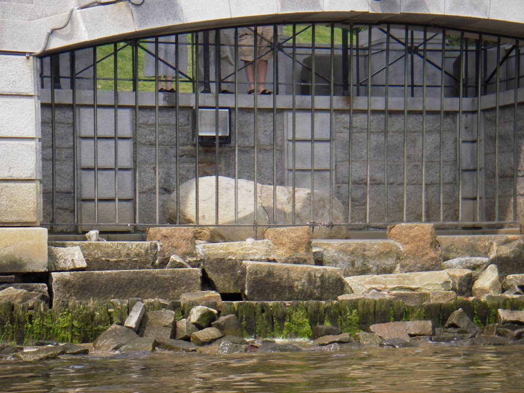
From Stephen's Field, we headed north towards Plymouth. This section of the harbor is protected from the rest of the bay by a seawall. It houses the Plymouth Rock and the Mayflower II. The Rock seemed much smaller than my childhood memories. From the ocean you can see the back of it through the grates. Despite the nice weather, the Rock had very few visitors.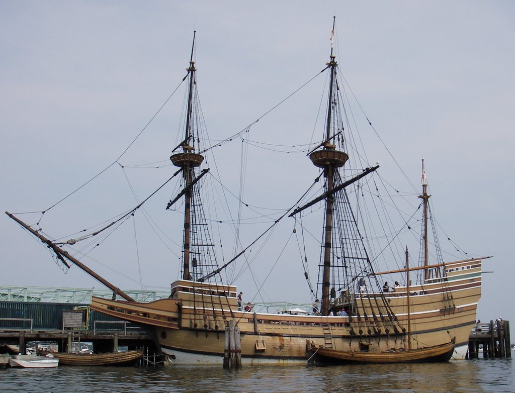
The Mayflower II also seemed smaller than I remembered. It was pretty cool looking though. Unlike the Constitution in Boston, the Mayflower II is accessible by water. No armed guards pointed rifles at us when we paddled up to the hull and peered in the windows. There were also two large dinghies at the Mayflower II that are replicas of the boat the Pilgrim's used to land on Plymouth's shore.
While checking out the Mayflower II we were treated to a mock pirate battle. One of the tour companies has a little pirate ship out in the harbor. When the tour boat gets close, the pirates attack the ship with water guns. The tour passengers are also armed. It was quite a site.
From the Mayflower II we headed out of the harbor under a bridge that breaks the seawall near the shore. Once out of the seawall we turned for Plymouth Beach which is across the harbor. Plymouth Beach is a tiny sliver of sand that forms the southern rim of Plymouth harbor. It is a popular spot for migrating birds, beach goers with boats, and kayakers. We saw several people in kayaks poking out along the beach.
From the tip of Plymouth Beach, we crossed over to Duxbury Pier Light, affectionately known as Bug Light, and then to Saquish Head Point. This was the trickiest part of the paddle because it involved crossing a fairly wide and busy channel.
From Saquish Head we meandered up Saquish Beach along towards Gurnet Light.
Saquish Beach was busy and full of SUVs. The only access to the beach and the small cottages that line it is by SUV. While it may sound horrible, it wasn't bad at all. The SUVs drove slowly and nobody was doing donuts on the beach. For the most part people were just lounging about in the sun.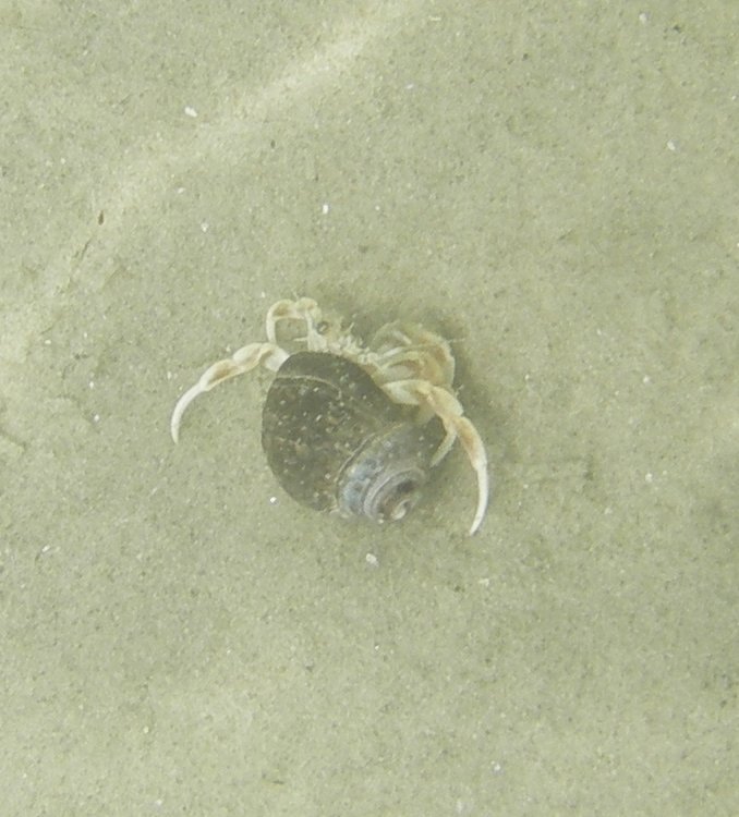
The water along Saquish was clear enough to see the bottom. The bottom was lined with seaweed covered rocks and the odd fish. While eating lunch, H and I followed a brave hermit crab around under the water trying to get a picture of him. I'm not sure who was crazier, him for not just bolting or us for persisting...
At the far end of Saquish Beach sits the Gurnet Light. This is the oldest wooden lighthouse in America. From the water it is hard to get a good view of the light because it sits high on highly eroded cliffs. From a distance, however, you can get a glimpse of its bright white sides.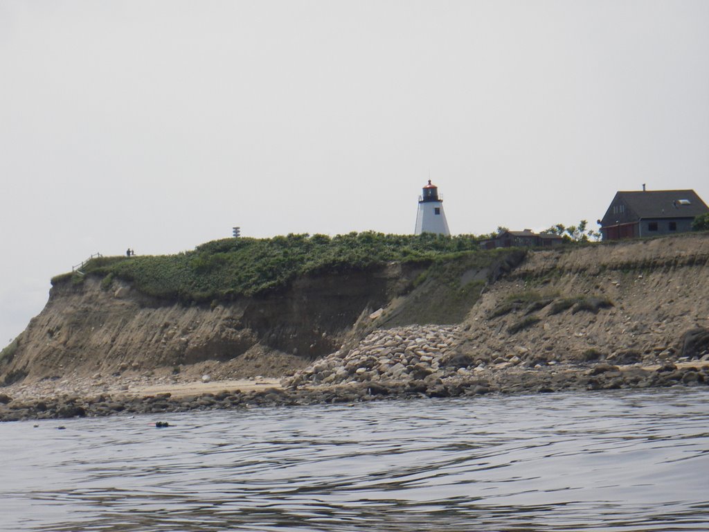
The water at the point was a wonderland. The water was crystal clear and we spent time mesmerized by the landscape of seaweed covered boulders and lobster traps. There weren't any fish in view, but that was OK.
We made our way back to Plymouth Beach by retracing our steps along Saquish Beach. While crossing the channel, H saw a skate along one of the shoals. We even got a chance to check out Bug Light because it was protected by a shoal that kept most of the boat traffic out of our way.
Back in the harbor, we followed the channel along Plymouth Beach to make our way back to Stephen's Field. It was low tide and as the guide book made clear, the harbor was mostly empty. The channel, which is clearly marked, has plenty of water and most of the paddle back was easy. Once we got to the point where we needed to break away from the channel the water got very shallow, but we never had to walk the kayaks.
Plymouth offered us an easy paddle with a bit of open water exposure, some history, and some gorgeous water gazing.
Subscribe to:
Posts (Atom)


